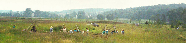
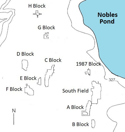
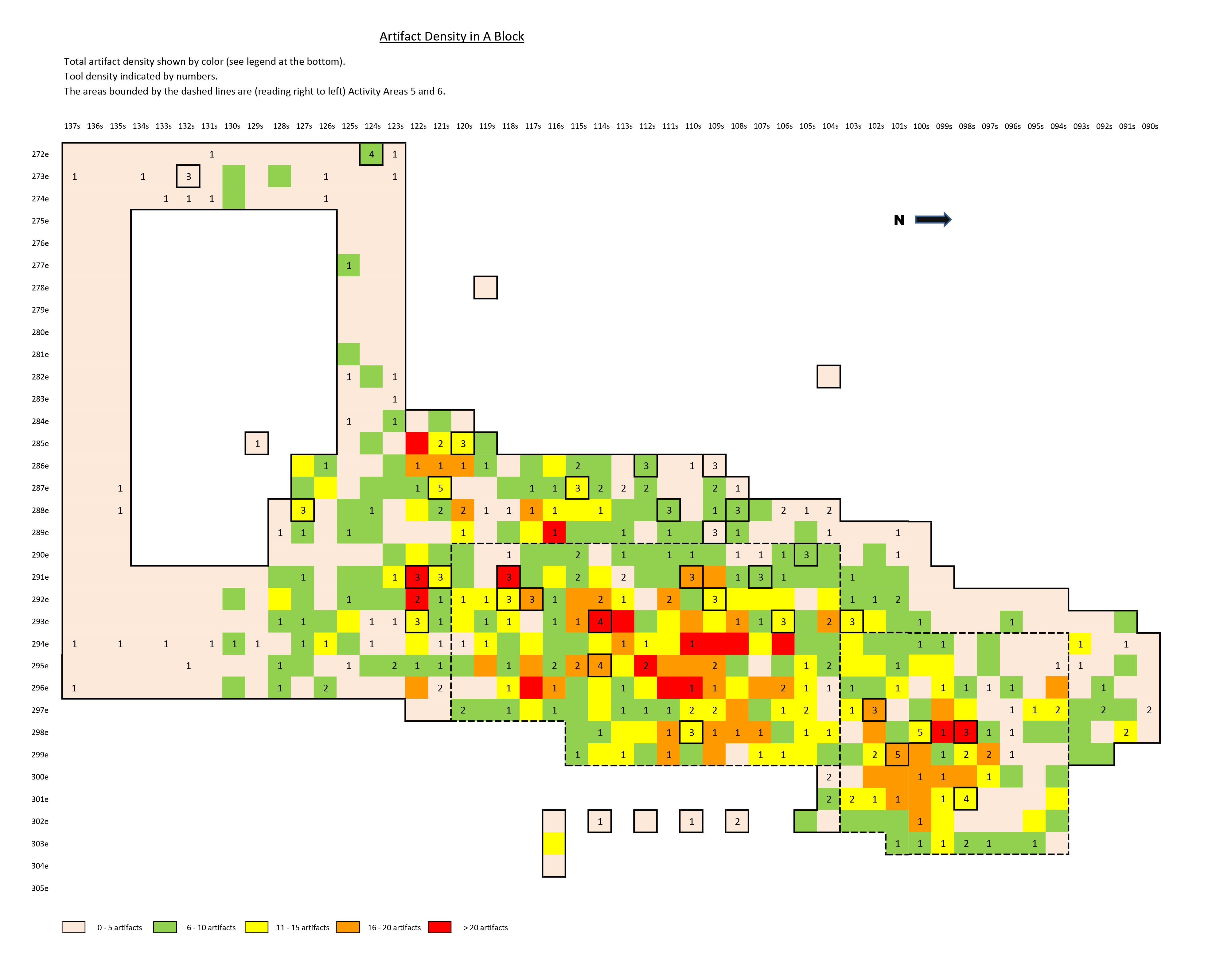
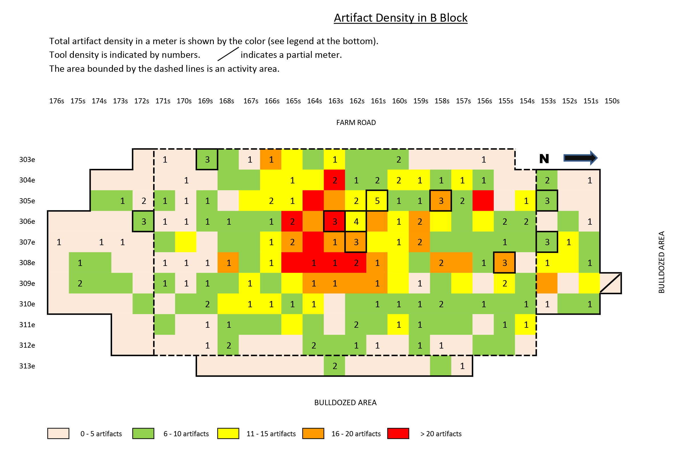
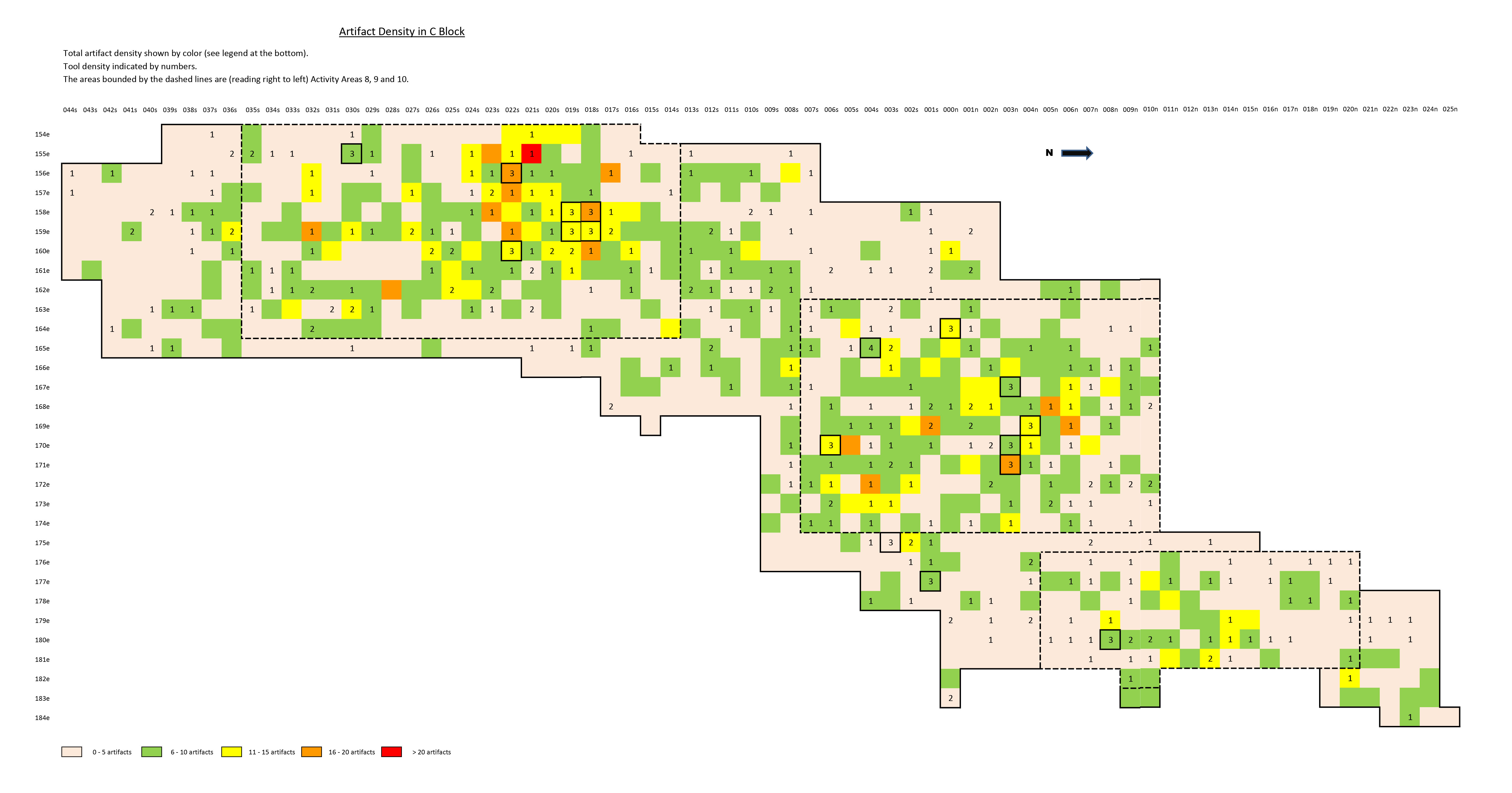
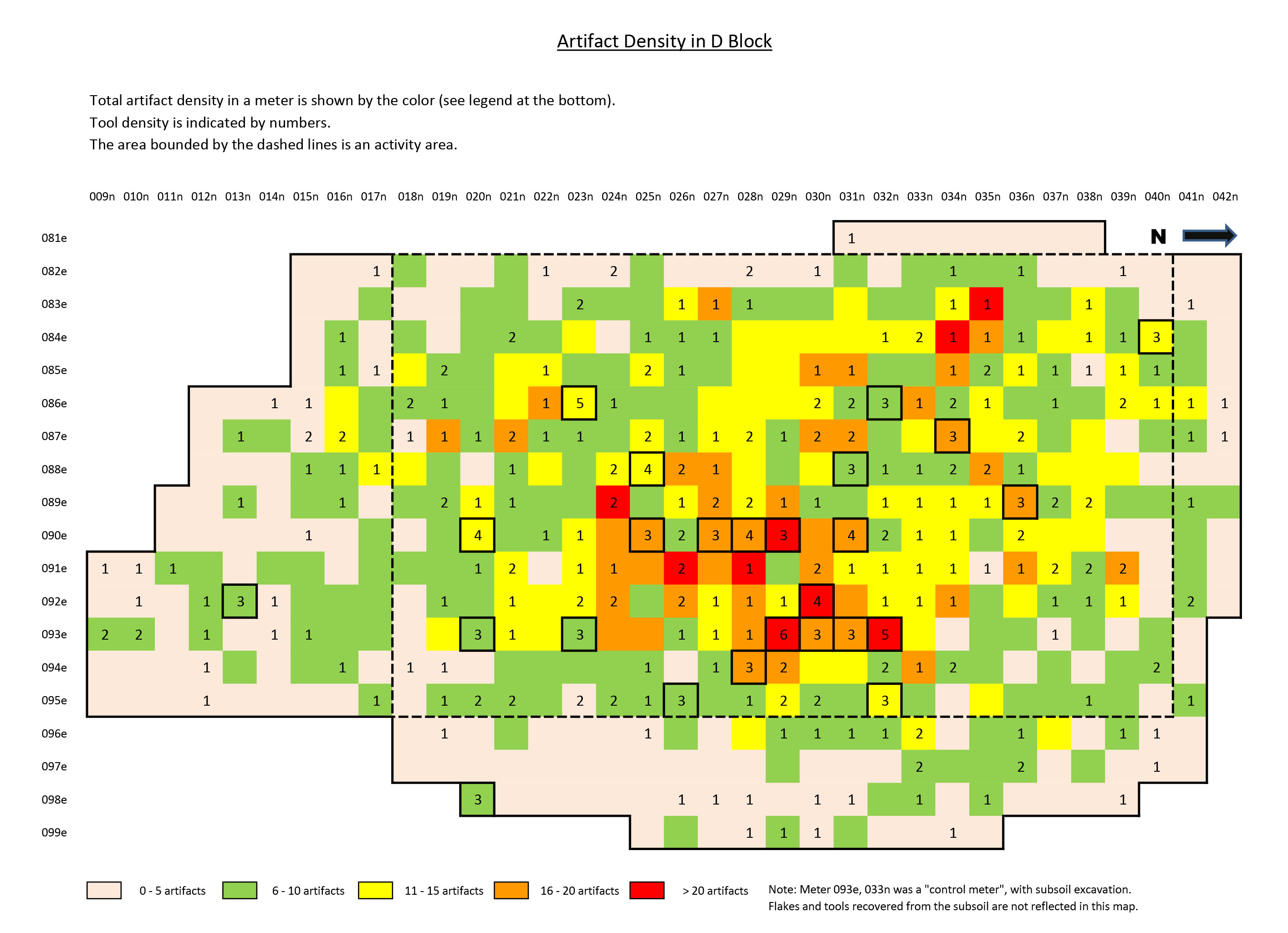
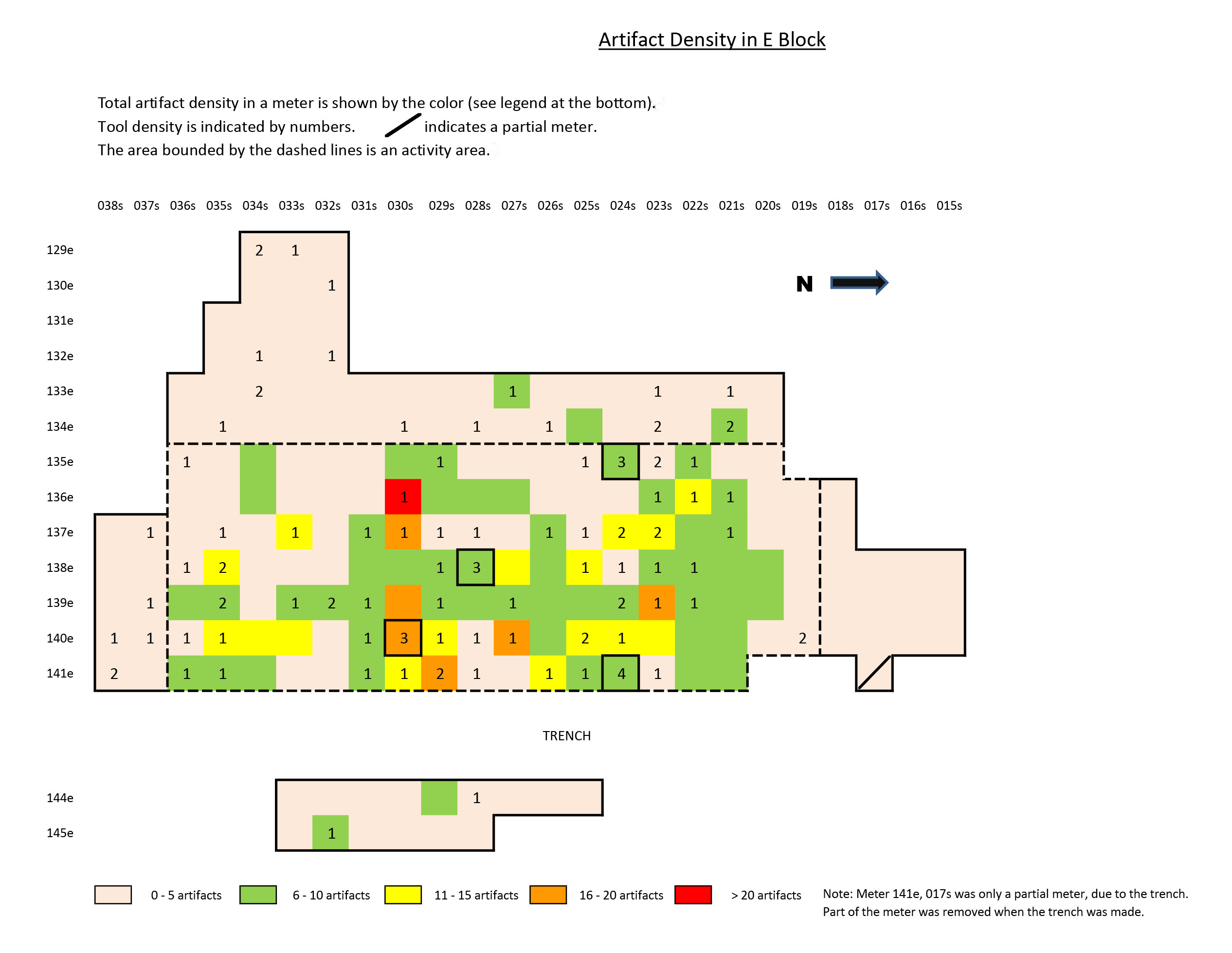
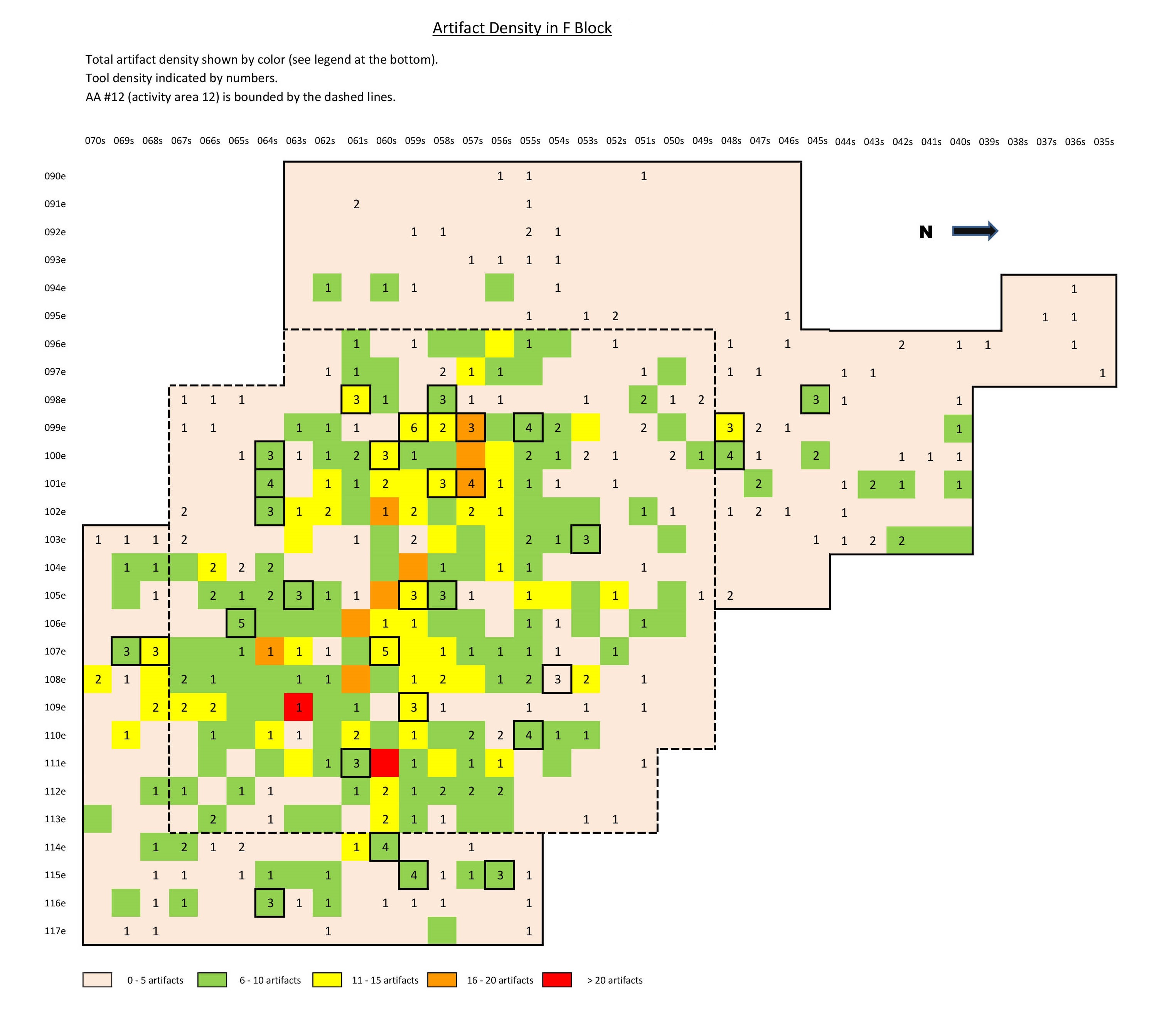
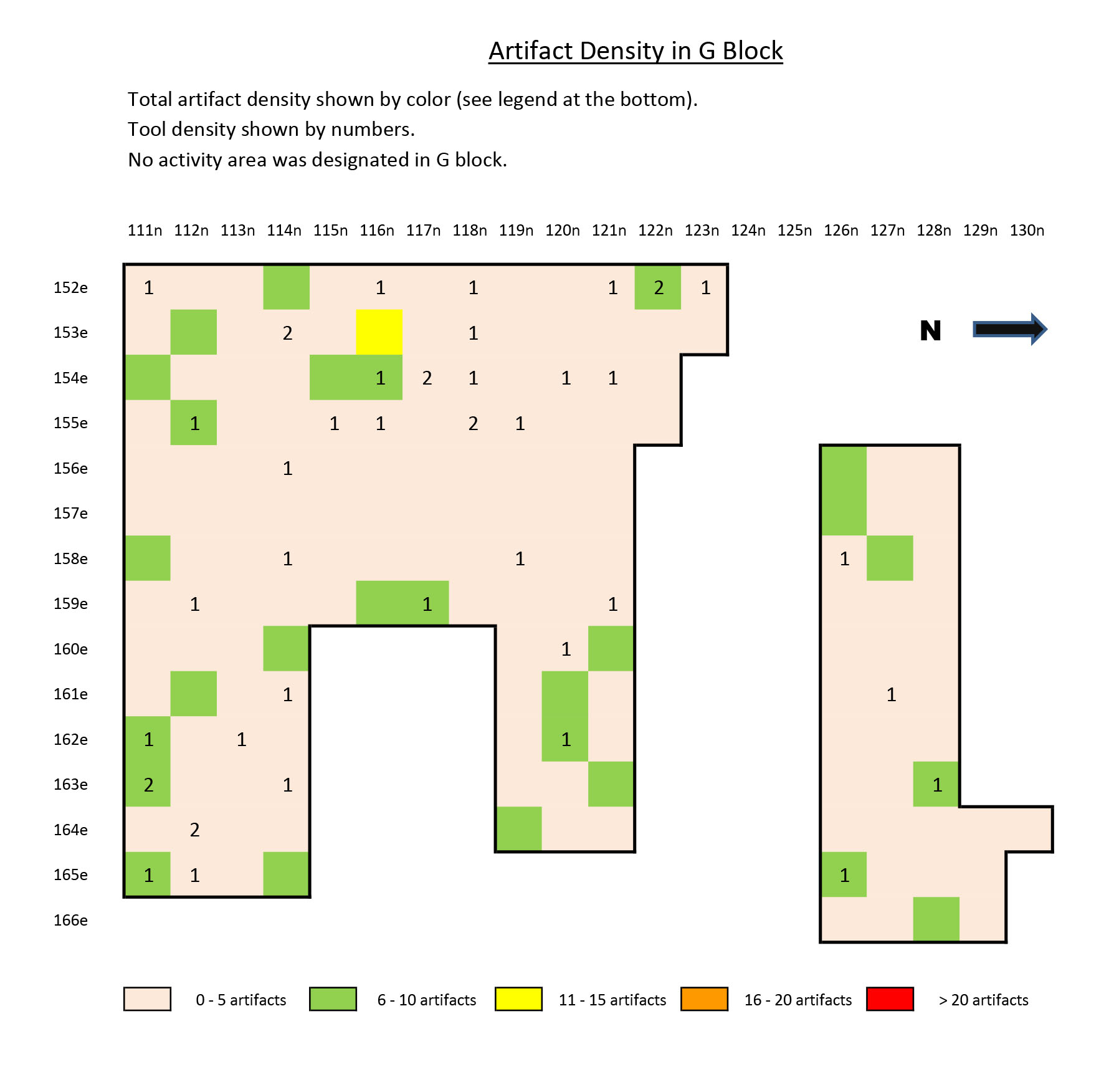
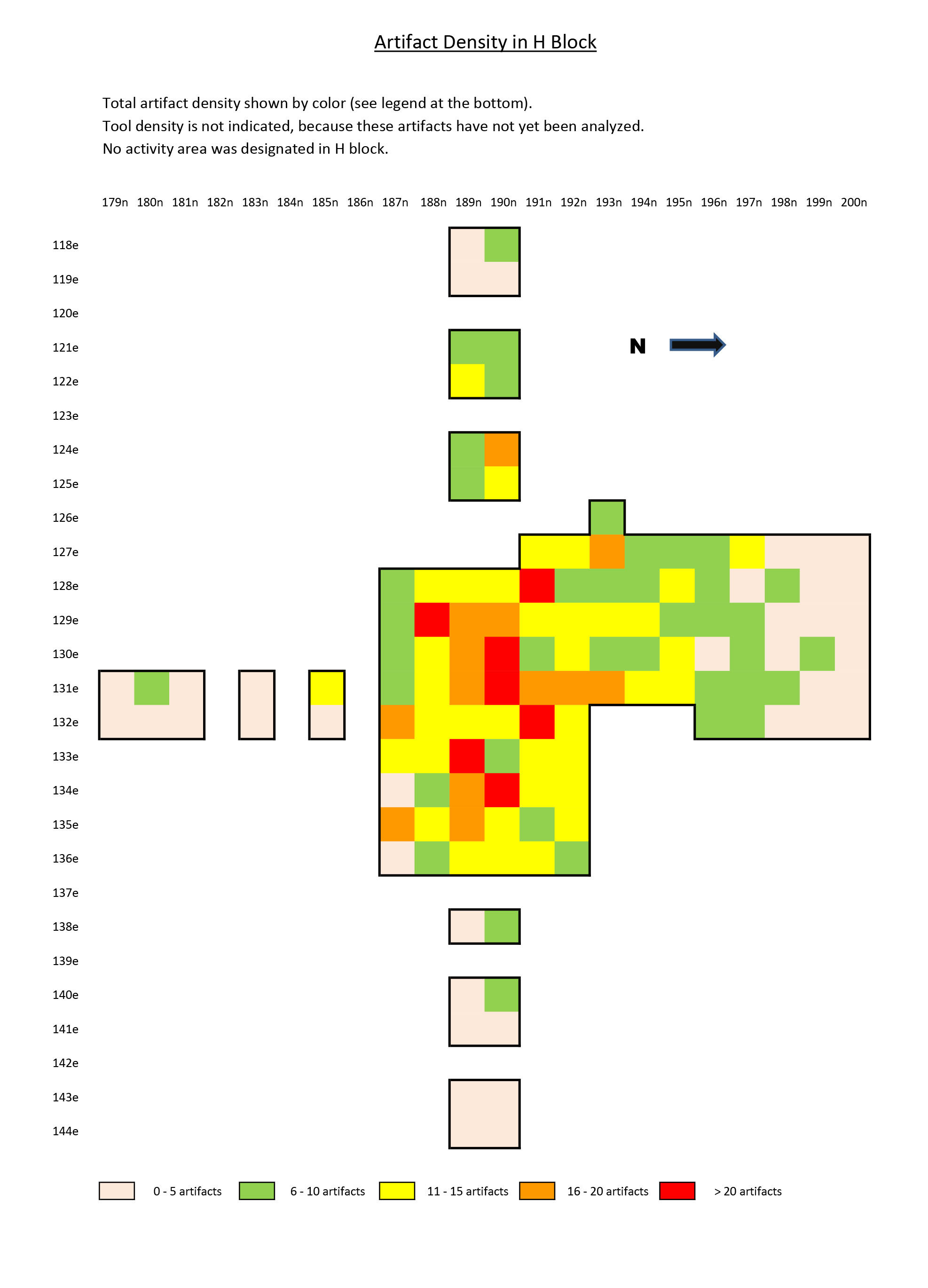
The map below shows the major areas excavated (excavation blocks) at the Nobles Pond site. We picked an area to dig based on surface collection, started digging in the center of the area, and continued outward until the artifact density dropped off at the edges.
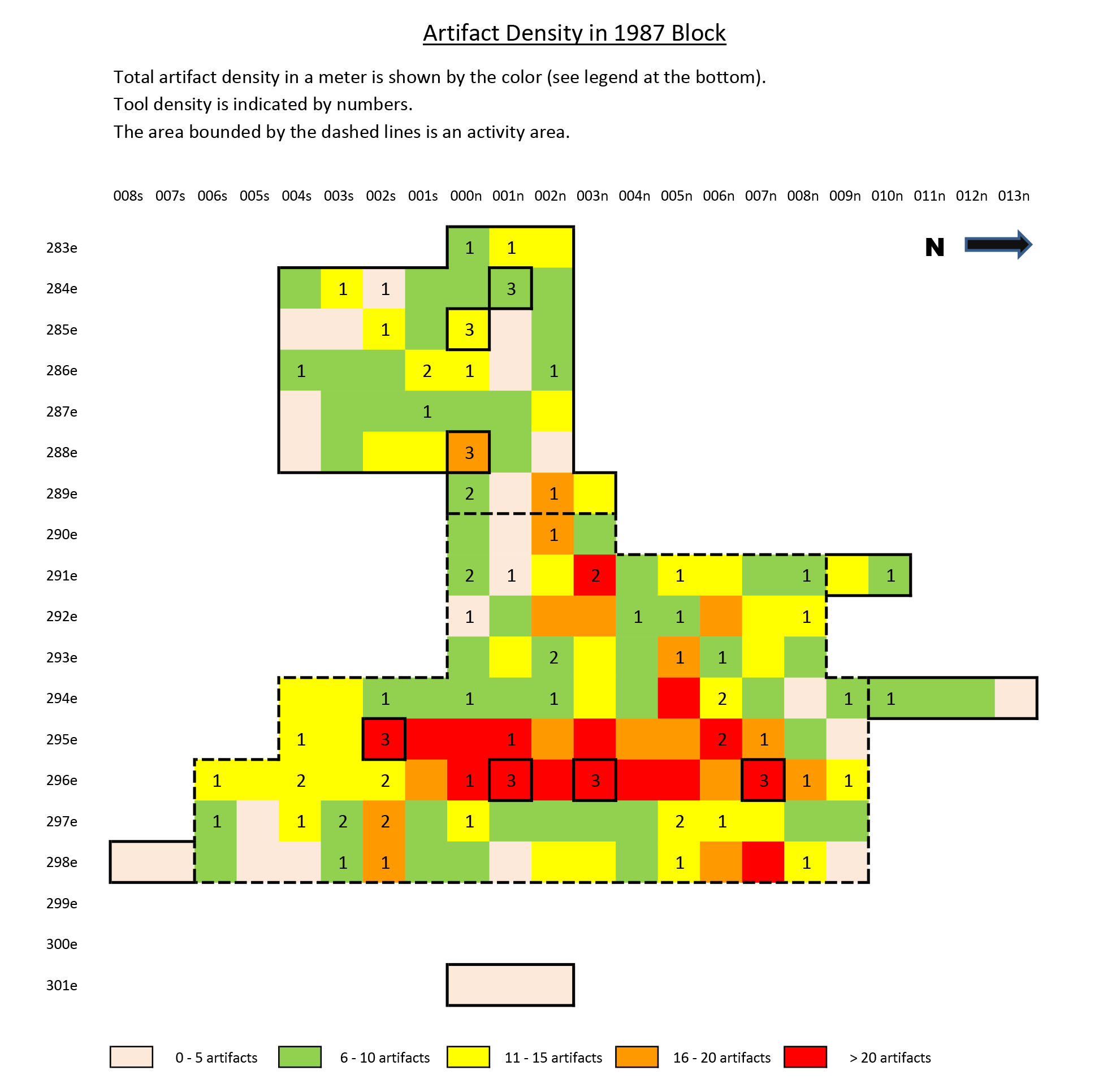
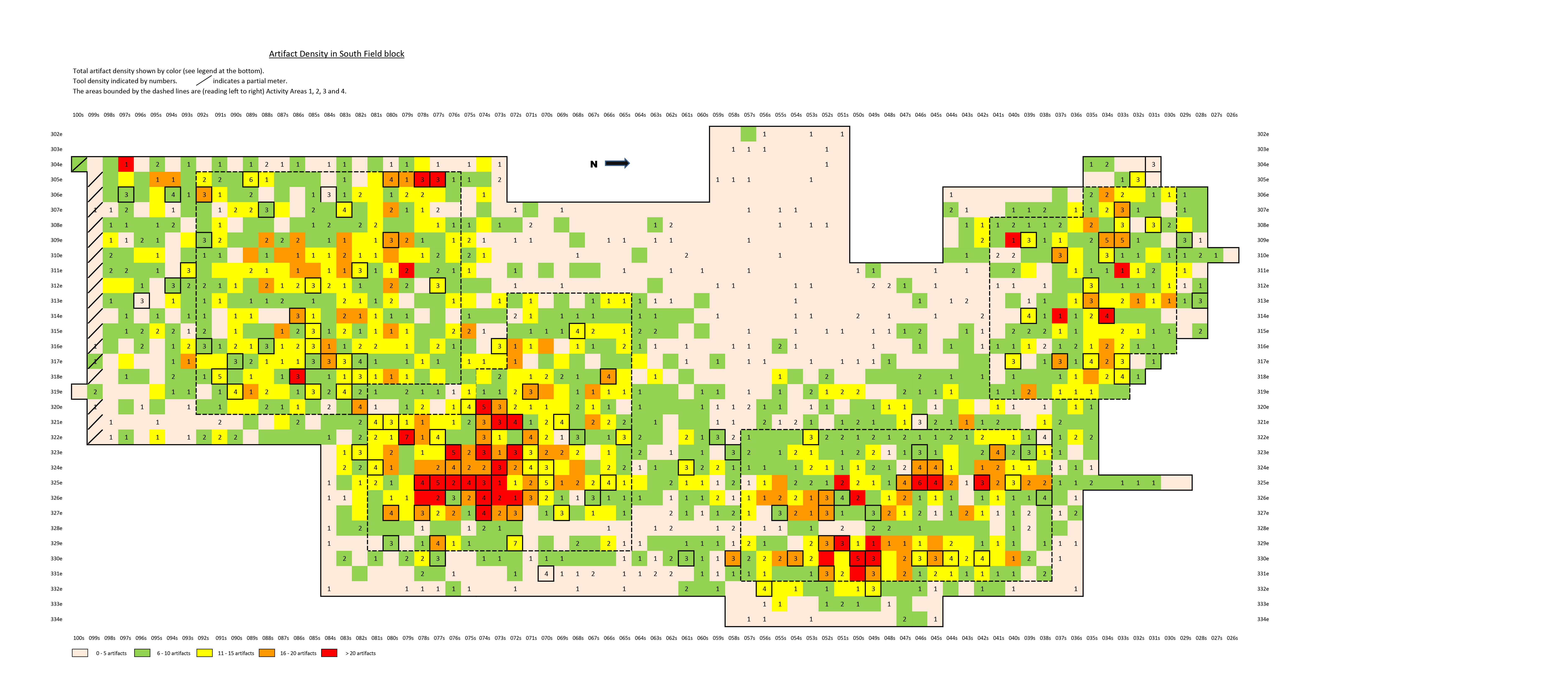
The artifact density maps for excavation blocks show the result of this procedure, with a high number of pieces per meter in the center of the block, and a low number of pieces in the meters around the edge of the block.
You can view an artifact density map by selecting a block from the list below, or you can click on a block in the excavation map.
- 1987 block
- South Field
- A block (nicknamed "Omar")
- B block ("Pig Lot")
- C block ("Bunny Hutch")
- D block ("Mouse House")
- E block ("Munchkins")
- F block ("Hog Heaven")
- G block ("Squirrel Crossing")
- H block ("Glory Hole")
