Nobles Pond Paleoindian Site

At present, this website is best viewed on a laptop or desktop computer. Results on a tablet or a smartphone may not be optimal.
Nobles Pond
            historical site marker

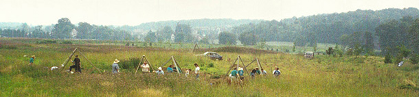
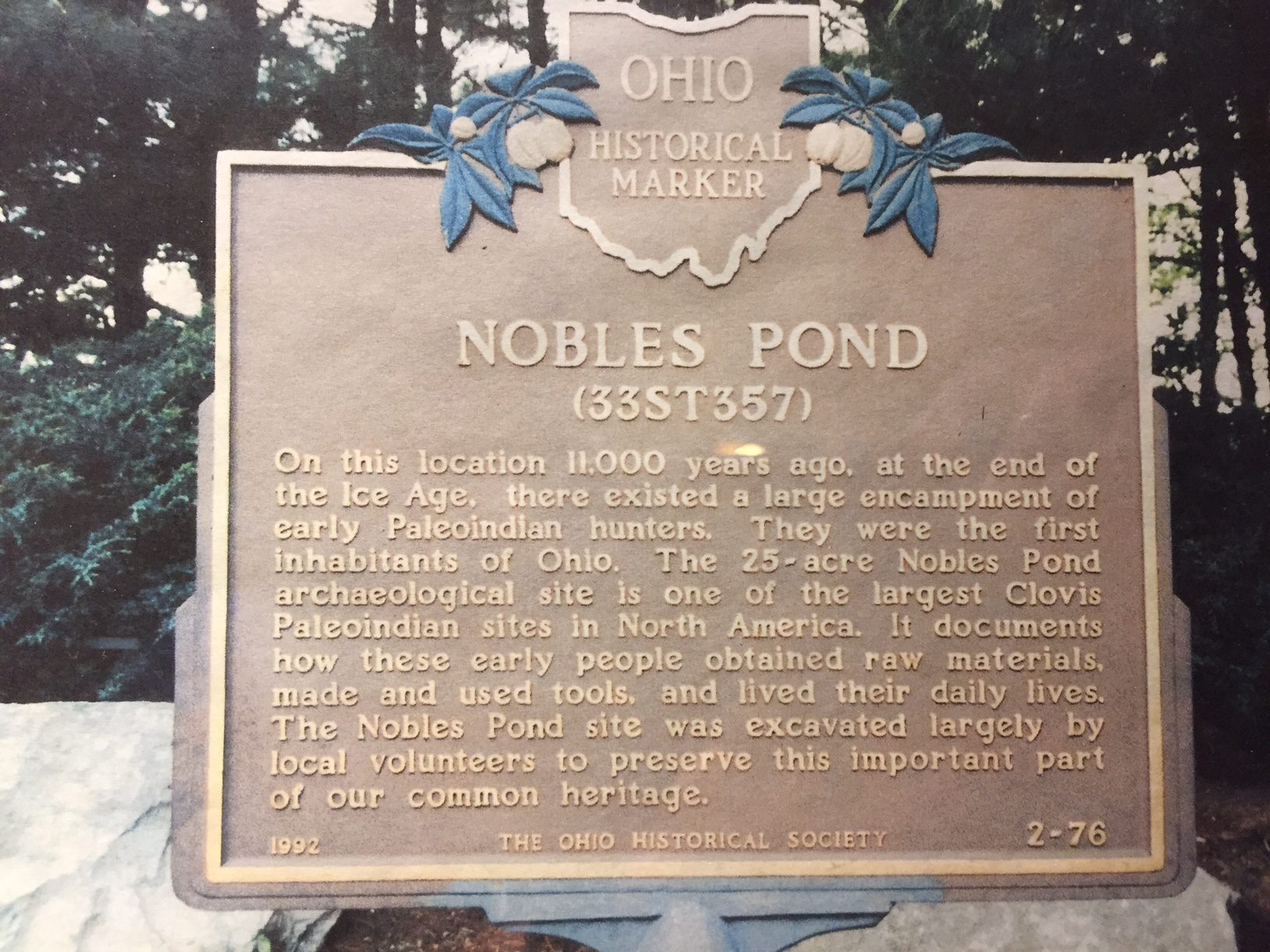
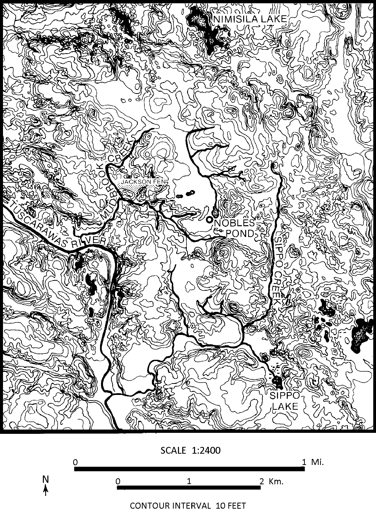
Approximately 11,000 years ago, Ice Age people (Paleoindians) lived at Nobles Pond in Jackson Township, Stark County, Ohio. Science knows little about these people, but they are considered to be the first inhabitants of Ohio after the glacial ice receded. Several Paleoindian campsites have been discovered, excavated, and recorded at this 25-acre site.

Photo of a fluted point.
         A link to the Fluted Points page.

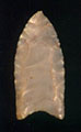
A characteristic tool of the Paleoindians is their special spear points, called fluted points (shown at right). These spear points were made in a unique way, during a limited period of time, which serves to identify the approximate time that these people were at Nobles Pond.

Photo of a
           trianguloid end scraper. A link to the End Scrapers page.

Another characteristic tool of the Paleoindians is a stone scraper of the type called a trianguloid end scraper (shown at left). Hundreds of these scrapers have been found at Nobles Pond, where they were mostly used for scraping animal hides.

Measured by area excavated, total stone tools recovered, or number of activity areas discovered, Nobles Pond is one of the largest known Paleoindian sites in the western hemisphere. This site provides a rare opportunity to learn about the Paleoindians who once inhabited eastern North America.

Site Number
33ST357 (33 = Ohio, ST = Stark County, 357 = site registration number)
Location
Jackson Township, Stark County, northeastern Ohio (USA)
Principal Investigators
Dr. Mark F. Seeman and Garry L. Summers
Site Type
Nobles Pond is a multi-component site whose predominant component is a Paleoindian occupation. The fluted points and preforms recovered from the site are similar to Gainey spear points (Michigan). The large number of end scrapers at the site suggest that this was a major hide-processing encampment.
Setting
The Nobles Pond site is situated on a glacial outwash terrace. The terrace is located just east of a fen (Jackson Bog), and immediately west of and adjacent to a glacial kettle (Nobles Pond) of about 11 acres (4.8 hectares). The site is located about 10 miles (16 kilometers) from the southern margin of the glaciated Appalachian Plateau, within the Tuscarawas watershed.
Site Area Map
Topographic map of the Nobles Pond area.
Published Reports
We have published a number of reports and are working on more. See our bibliography.
Top | Home | About Us | Artifacts | Fieldwork | Lab | Bibliography | Contact
Privacy | Mission | Credits